Maritime operators and authorities are raising alarms over a sharp increase in GNSS (Global Navigation Satellite System) and AIS (Automatic Identification System) disruptions across strategic waterways in the Middle East. Recent incident reports point to widespread interference and anomalous vessel tracking behavior.
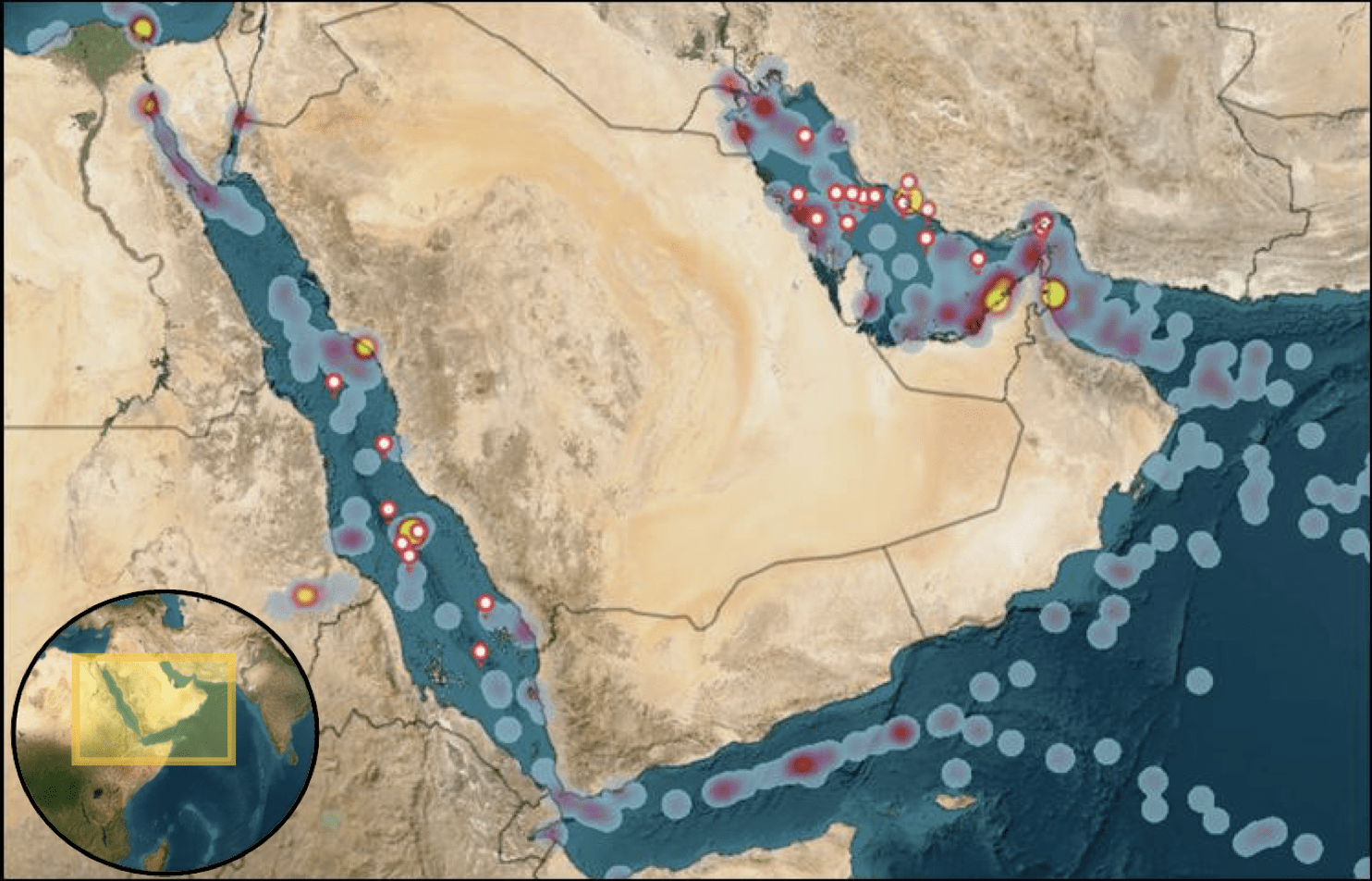
Between October 3 and 7, the UKMTO received numerous reports of GNSS jamming and AIS anomalies centered around Bandar-e-Pars, the Strait of Hormuz, and Port Sudan. Ships in the Gulf, Red Sea, and Suez Canal corridors have also exhibited erratic AIS speed readings and positional ‘jumps.’
Amid the disruptions, Qatar’s Ministry of Transport temporarily imposed a national navigation suspension on October 4. The ban was later partially eased, allowing vessels to navigate during daylight hours under restrictions, while night movements remained limited. Meanwhile, LNG carriers and other key vessels reportedly received exemptions and continued operations.
Masters are being reminded not to rely solely on electronic navigation systems or autopilots. Instead, operators are urged to cross-verify positions using radar, visual bearings, or traditional navigation methods, and to log and report any suspected interference events.
This uptick in interference is not isolated. Earlier in 2025, GPS jamming and spoofing spikes were flagged near the Strait of Hormuz, coinciding with regional tensions and airstrikes. The disruption has already been linked to at least one collision between tankers, where anomalous positioning was cited as a potential factor.
As such, the sailing environment in Middle Eastern waterways is increasingly viewed not merely in terms of geopolitical risk, but as a zone where electronic warfare tactics may directly endanger maritime safety.